|
|
For
participants only. Not for public distribution.
|
Progress Report #1
John Nagle |
This is the first in a series of monthly progress reports.
| 44 | weeks to go. |
We're moving forward. We have a design, resources, a vehicle, and several good people. We have much hard work ahead.
The biggest technical challenge we face is "sensor myopia" and its implications. We can get sensors that will tell us "where", but sensing "what" is an unsolved problem, except for a few special cases. One of those special cases is road-following, which has been done successfully by several groups. We can make that work. Everything else we must do with "where" sensors.
The most powerful, yet the most troublesome, sensor is a scanning laser rangefinder. Resolution in both angle and range is quite good. Adequate data rate and range can be achieved. The hard part is the mechanics of scanning. Scanning rangefinders are about where television was in 1930; a variety of mechanical arrangements have been tried, with varying degrees of success. We have to adapt our control strategies to live within the limitations of what's possible with mechanical scanning, unless someone comes up with a breakthrough in the immediate future.
We're going to move forward by testing with an off-the-shelf unit while working on that problem.
Subsystems
Vehicle
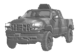
We have purchased a Polaris Ranger 6-wheel drive vehicle, along with a small trailer on which it can be carried, and will pick these up from the dealer in Sunnyvale in a few days.
Cecilia Oakley is in charge of the vehicle actuation systems.
Overall mechanical design and equipment placement on the vehicle needs attention.
We will need to mount an auxiliary generator on the vehicle, probably a 3KW unit.
We have a local car shop lined up which can replace the existing 8-gallon fuel tank with a larger, and crash-resistant, racing fuel cell.
DARPA recently added some new lighting and sound requirements, including flashing yellow lights, brake lights, and a 119 dB (siren-level) warning device. (Yes, they really want 119dB; I asked. It's above the threshold of pain, by intent. Nobody who encounters the vehicle will go near it.)
Workspace
We're looking for about 1600-2000 square feet of building with an overhead door, and a nearby fenced area suitable for vehicle testing. We're currently talking to realtors about two suitable locations, both in Redwood City. One is in the Redwood Junction complex, surrounded by a triangle of three railroad tracks. The other is in an automotive repair district near US 101.
Sensors
Radars
We now have two Eaton VORAD radars, and they're working on the bench. One is looking out my window at a road right now. These proven devices should be good at keeping us from running into solid obstacles.
Laser rangefinders
We have ordered a stock Acuity Research 360° line scanner with a 16 meter range, mounted on a pan/tilt head. This is enough to allow us to develop and debug systems for low-speed driving. It doesn't have the range, field of view, or data rate for the actual race. No off-the-shelf unit does. Bob Clark is working to design new laser rangefinders for our application. He has two prototypes under construction.
GPS/inertial/compass system
We have obtained some advice from Stan Honey in this area, but have not yet done much. We need someone devoted to this subsystem.
Other sensors
We need several short-range ranging sensors (sonar or microwave) spaced around the vehicle. This became more critical on April 1, when DARPA announced that all the vehicles would start simultaneously, 20 meters apart. With previous plans for a staggered start, we could probably have skimped on side-looking and rear-facing sensors. Now, we had better be capable of evasive action if in danger of being run over by some monster truck.
We need a speedometer (a downward-looking Doppler radar device), tachometer sensors on the engine and driveshaft. We also need water sensors to detect entry into water, and to detect when it's getting too deep.
Software
Road following
John Pierre is making good progress in implementing a RALPH-type road follower (the approach used with the CMU "hands off across America" project), and expects to be testing against video data within two weeks.
John Nagle has a QNX driver for FireWire cameras working.
We have rough design documents, but need to firm up the overall software architecture soon.
Groundside systems
Bruce Baumgart is back from China and ready to spend more time on map data acquisition and processing. We've been trying the mapping program from "earthviewer.com", which demonstrates what can be done given available map, aerial photo, and elevation map data. However, Earthviewer does not have high-resolution data for the race area.
Adminstration
We have registered our organization with the California Secretary of State. We have money in the bank. We have an insurance carrier lined up for general liability coverage, and will buy that as soon as we settle on a workspace.
